
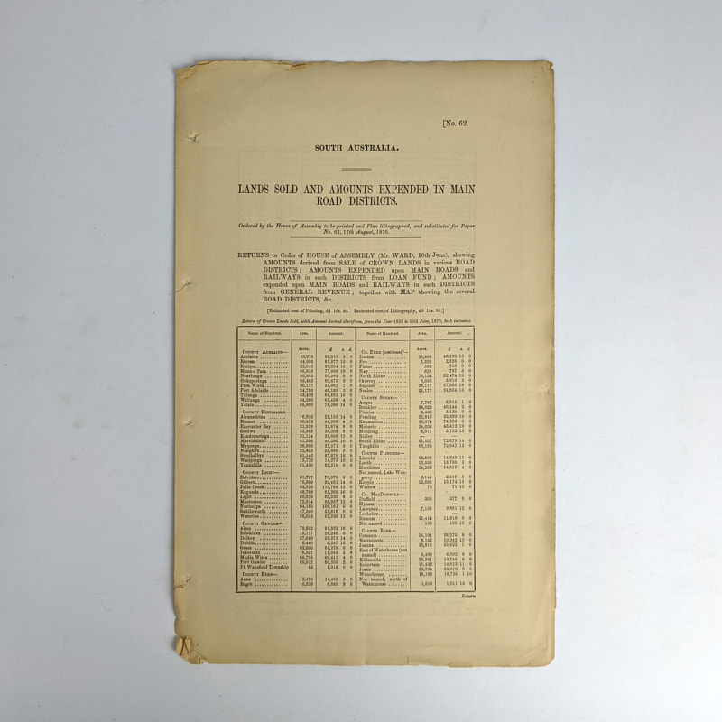
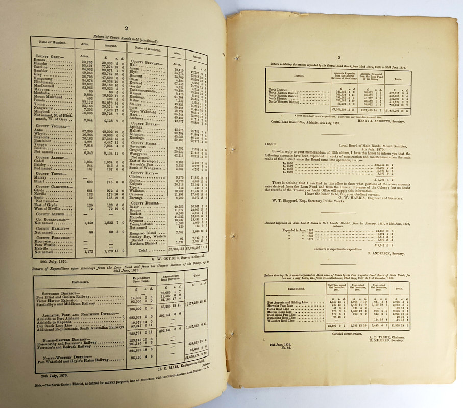
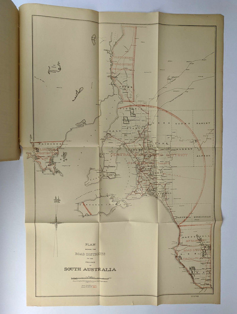
Lands Sold and Amounts Expended in Main Road Districts
South Australia
Adelaide: Frazer S. Crawford, Photo-Lithographer, Surveyor Generals Office, 1870.
First Edition.
34cm x 21.5cm. 3 pages, 1 folding map. Self-wrappers.
South Australia House of Assembly Paper No. 62, 17th August, 1870, being tables of returns showing amounts derived from sale of crown lands and amounts expended upon main roads and railways together with a map, Plan Shewing the Road Districts in the Province of South Australia.
Minor chipping and closed tears to edges. 4cm closed tear to map at horizontal fold near hinge tail. Very Good Condition.
SOLD
Add to WishlistOn your Wishlist - View List
Add to Wishlist