
Report on the Geology and Mineral Resources of the District Between Charters Towers Goldfields and the Coast
Robert L. Jack
Brisbane: James C. Beal, Government Printer, 1879.
First Edition.
34cm x 21.5cm. 28 pages, black and white illustrations, 1 folding colour map (of 2). Side-stitched self-wrappers.
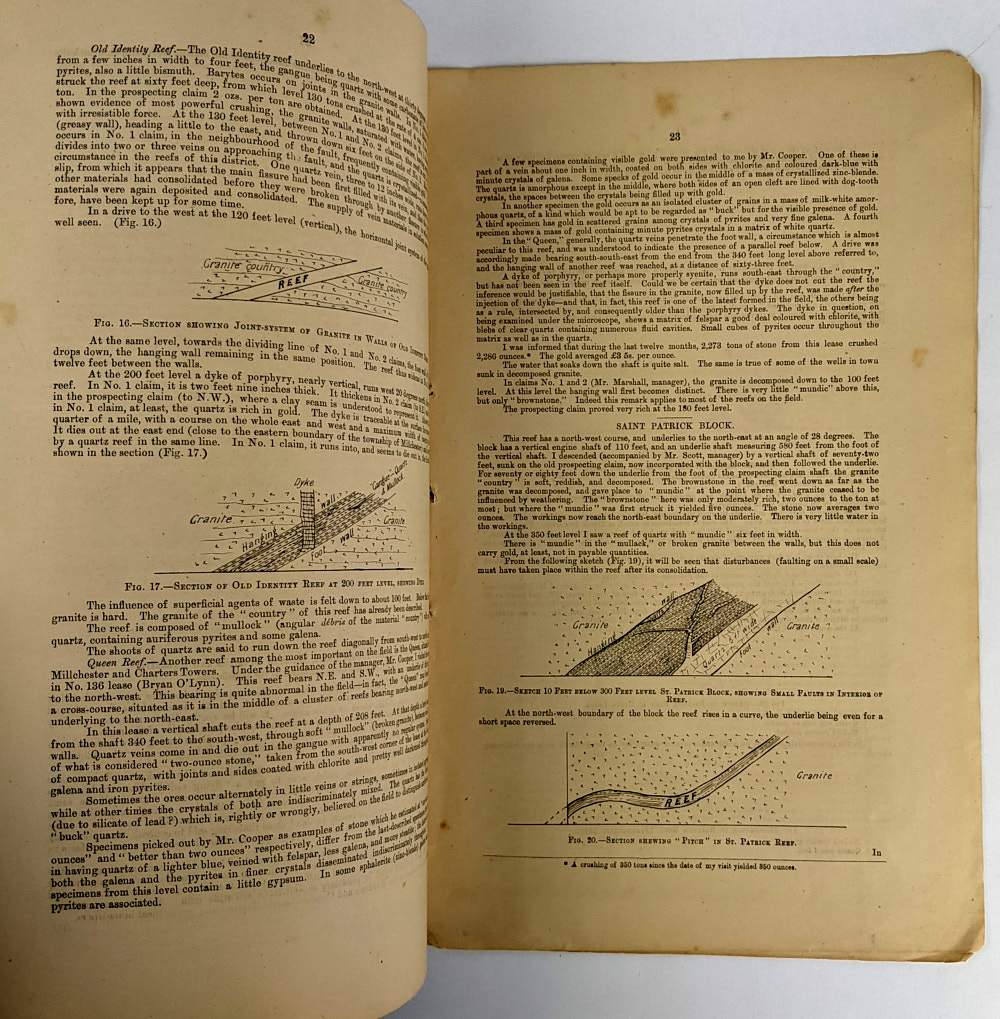
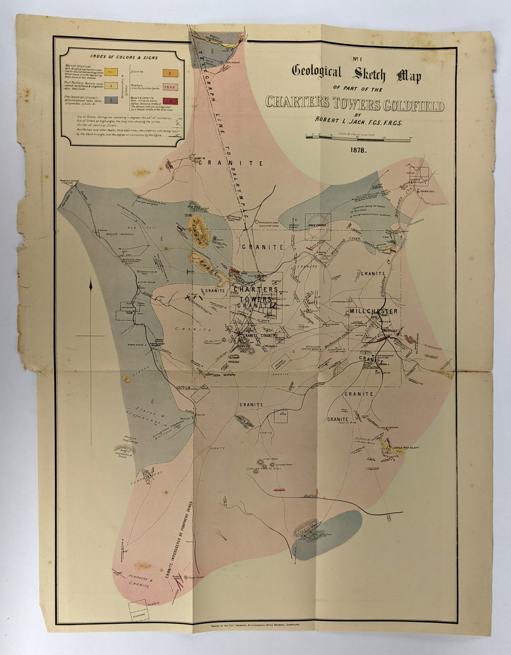
Report by Geological Surveyor, Northern Queensland, Robert Logan Jack (1845-1921) on the Geology and Mineral Resources of the District Between Charters Towers Goldfields and the Coast, with sketch illustrations and figures in the text and map of Geological Sketch Map of Part of the Charters Towers Goldfield, 1878. This copy missing the Sketch Map of the District Between Charters Towers Goldfield & the Coast.
Stitching coming loose, binding tender. Some foxing and corner creasing. Map loose with some foxing and a couple of closed tears to edges. 1 map missing. Good Condition.
SOLD