
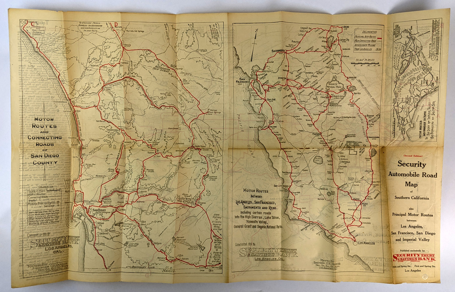
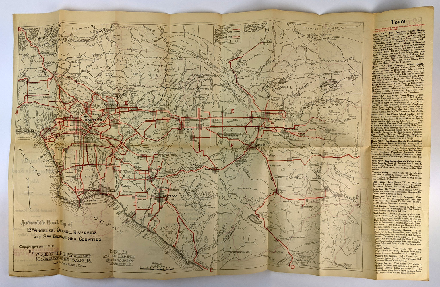
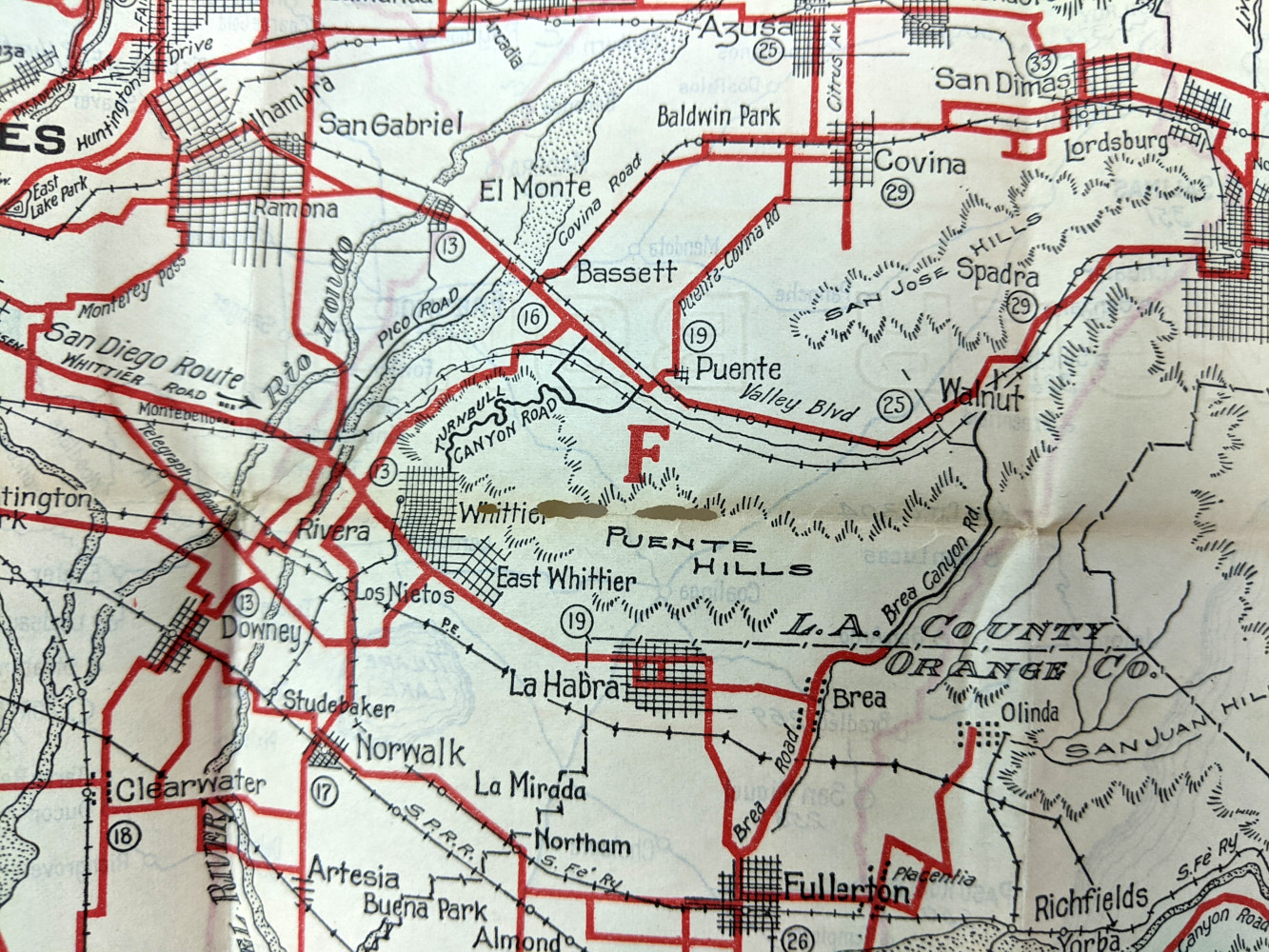
Security Automobile Road Map of Southern California
O. K. Parker
Los Angeles: Security Trust & Savings Bank, 1916.
Second Edition.
40.5cm x 70cm. Folding two colour map.
Also Principle Motor Routes between Los Angeles, San Francisco, San Diego and Imperial Valley. Scarce early 20th century American road map with 4 maps: One side with a large Automobile Road Map of Los Angeles, Orange, Riverside and San Bernardino Counties and accompanying text on tours; 2. Motor Routes and Connecting Roads of San Diego County; 3. Motor Routes between Los Angeles, San Francisco, Sacramento and Reno, Including certain roads into the High Sierras, Lake Tahoe, Yosemite Valley, General Grant and Sequoia National Parks; 4. Motor Routes Los Angeles to Yuma via San Diego and Imperial Valley, San Bernardino and Salton Sea. 2 copies recorded in OCLC.
Minor tanning and edge wear. Small bubble to title panel. A few very minor holes along fold lines. Very Good Condition.
SOLD